| Use
Explorer for a better display of this Website |
Richmond
Greenway Receives $1.9 Million Capitol Funding Grant
The Metropolitan
Transportation Commission recently announced recommendation of $1.9
million in Transportation for Livable Communities (TLC) funding to
construct a trail and greenway on 2.5 miles of abandoned Santa Fe
Railroad right-of-way. The trail project, sponsored by the City of
Richmond, Rails-to-Trails Conservancy, and the Community Youth
Council for Leadership and Education (CYCLE) will create a link to
local and regional parks and trails, schools, Richmond BART/Amtrak
station, downtown shopping and newly proposed residential and
commercial developments, including a new affordable housing
development.
MTC received 39 capital
project applications totaling about $46 million in requests.
Approximately $9 million is available in federal funds for TLC
capital projects through the Transportation Enhancements and
Congestion Mitigation and Air Quality programs for this cycle. For
more information contact Kate Bickert at RTC(kbickert@transact.org)
or Judith Henderson at CYCLE (c-y-c-l-e@email.msn.com).
The Richmond Greenway will
hook up with the Ohlone Greenway at San Pablo Avenue, where a
portion of Baxter Creek surfaces ( see www.creativedifferences.com/baxtercreek.).
The Ohlone Greenway is a landscaped linear park along the former
Santa Fe right of way in Albany and El Cerrito, where it parallels
the BART right-of-way. Albany’s section is broader and more
attractive than El Cerrito’s, but there are some interesting
sections in El Cerrito, including crossings by two branches of
Cerrito Creek, a recently daylighted bit of creek near El Cerrito’s
City Hall, and a garden featuring plants that have been around since
the Jurassic. For more information about the history of the Ohlone
and Richmond Greenway, see www.bpfp.org/SFRW/OhloneGreenway.htm.
CONTINUE
|
The
terminal site is historic in that it was also the point of departure
for Richmond’s Santa Fe trains and ferryboats heading to Tiburon and
San Francisco from 1900 until the 1960s, and then again for a short
time in the aftermath of the 1989 Loma Preita earthquake to ease
traffic congestion while the Bay Bridge was closed.
 |
| Brooks
Island |
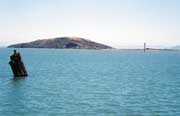
From the Sheridan Observation
Point is a great view of Brooks Island. The island is sacred to Native
Americans. Access to Brooks Island is by reservation only, and is
accessible by East Bay Regional Parks District’s Brooks Island Kayak
trips. Trips offer an easy, short 0.5 mile paddle in the protected bay
water to the island. Introduction on equipment and strokes is provided
along the trip through the Richmond Harbor, followed by a paddle along
the shoreline of the island, and a visit to the sand spit for potluck
lunch and a two-mile hike around the island.
CONTINUE
|