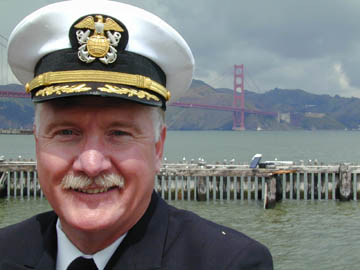
Commander Steve Thompson NOAA, National Ocean Service, San Francisco Bay Project Manager
Published: June, 2003
Although the acronym NOAA may sound like something in a James Bond movie or secret document, it actually stands for the National Oceanic and Atmospheric Administration. It is a federal agency (Dept. of Commerce) and home to one of the seven uniformed services in the United States, the NOAA Corps. (Can you name the other six?)*
Most people are familiar with NOAA because of the National Weather Service. NOAA satellites provide the weather images that you see on your TV screens every night. In the San Francisco Bay Area, NOAA also operates the National Marine Fisheries Service (NMFS) and the National Ocean Service (NOS).
The National Marine Fisheries Service is involved with commercial and recreational fisheries, endangered species, and habitat protection. Salmon and steelhead are the primary listed fish species in this region, but there are also marine mammals. NMFS also works to protect the benthic habitat. Benthic is the Greek term meaning the bottom, the floor of the sea, and includes the habitat and the organisms that live there. Bottom feeders. Oysters, for instance; we’re trying to restore the native oysters in the San Francisco Bay. We’re also looking into getting more Dungeness crabs back into the Bay.
The particular office that I manage is part of the National Ocean Service. Our role is to bring science, management, and public policy together. Our goals are to promote healthy coasts, ensure safe navigation, integrate coastal and ocean science with public policy and prepare ourselves for coastal hazards. Coastal Zone Management and the National Marine Sanctuaries are part of this office, as is the Office of Coast Survey, and our HAZMAT office for spill response. Sanctuaries in this area include the Gulf of the Farallones and the Cordell Banks, just outside the Golden Gate.
The Office of Coast Survey provides navigation services, such as nautical charts and the Coast Pilot, which we try to keep as accurate and as up-to-date as possible. The Coast Pilot is a kind of map and provides written details of what you can expect along the coast. It describes entrances to harbors, what you can expect along the wharfs, the length of the piers, what kind of power to expect, and what kind of support. We also maintain tide stations to monitor water heights. We work with the local maritime community to provide quality control of PORTS, which is Physical Oceanographic Real Time System. This provides tide, current, water and air temperature, salinity and other information to recreational boaters and to the Bar Pilots that bring the large commercial ships into the Bay.
We also work with the Coast Guard very closely, in oil and HAZMAT spill response, and for navigation services. And we have charting responsibility for the entire Exclusive Economic Zone, or EEZ, of the United States. The EEZ extends 200 miles offshore and there are still parts of the United States EEZ that have yet to be charted with modern technology. A few areas of the charts still reflect depths that were sounded by lead line, years and years ago. We concentrate our surveys on the areas that get the most use. So ports and harbors and approach areas in Alaska, for instance, where the oil tankers get updated more frequently.
My geographic area of responsibility includes all of the San Francisco Bay, up through Sacramento, all the navigable rivers, including the San Joaquin and Sacramento Rivers. I deal with the Ports of Sacramento and Stockton, all along the Carquinez, and the orts of the Bay. My current responsibilities don’t extend beyond the Golden Gate, but we have a fleet of ships conducting fisheries and oceanographic research, and hydrographic ships that are out there measuring the depths, gathering information to produce nautical charts.
*US Army, Navy, Air Force, Marine Corps, Coast Guard, Public Health Service
