Guy Span
Published: December, 2004
MTC operates on its web site the “511 Taketransit Trip Planner” that is highly unfriendly to the both Harbor Bay and the Alameda Oakland Ferry. Essentially this web page allows the user to input their location (street number and name or two cross streets) and town of origin and the same information or a landmark for the destination city. Then the user can select a start time, an arrival time (that will back you into a start time) or more options. With that information, the Trip Planner will plot your course using transit from origin to destination and price the journey, as well. There is another option that lets the user select a priority in either pricing or speed.
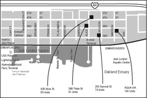
Other features include a highly cartoonish map that is slow to load on DSL and shows no features of either Alameda’s ferry terminals or, for that matter, Oakland or Vallejo’s. This map even thinks the Southern Pacific Railroad still operates in Alameda, despite the fact that it hasn’t been there since 1941 and Alameda’s real railroad, the Alameda Beltline, removed most of the tracks four years ago. However, if you want to see a nicely detailed transit map, look at the one used on AC Transit’s web site. It’s filled with crisp detail, loads quickly and changes views easily. It even includes detailed views of both Alameda’s ferry terminals.
Another obvious problem with the Trip Planner is that if the user gets more than a few blocks away from the ferry terminal (say Atlantic and Main in Alameda), the Planner will never offer a ferry trip as an alternative. The planner “thinks” rather than taking a bus a few blocks to the terminal (or walking) it’s better to take a bus the entire length of the island to drop down to the Fruitvale BART station. The same thing happens when the Planner is used near the Harbor Bay ferry. While AC Transit and other systems offer a link on their Web Sites to the Trip Planner, neither the Alameda Oakland Ferry nor Harbor Bay sponsor such a link (for good reasons).
The Planner also has no idea of the ferry ticket cost options or whether free transfers are offered. It only offers the single fare one-way price, despite a number of discounts being available, including Alameda – Oakland 10 trip rides that come with both an AC Transit and Muni transfer. The Planner just adds the Muni cost to the total, making the ferry unlikely to ever qualify for low-cost service. Vallejo has the same problem, as the Planner fails to note the one-day pass (or the ten-ticket book) reduces the cost to $7.50 (from $9.50) and that this also comes with a Muni transfer, as well. This criticism applies to most of the other transit services, where discounts for multiple rides are available along with transfer programs, but never mentioned in the Planner. These are very useful things a stranger to town (or transit) might like to know.
Then there’s the walking feature. This little device supposedly lets you limit or expand how far you wish to walk to a transit service or your destination. But it doesn’t seem to function. For example, if you start a trip in Vallejo on Market St., even though you specify Vallejo as the point of origin, a glitch forces you to start at Spear and Market in San Francisco. That’s not helpful, but the best part is that the traveler is now in sight of the destination (Ferry Building), a block and half away and the Planner suggests waiting for the #7 bus and paying $1.25 for this two-minute thrill ride, despite the fact that a 15-minute walk had been selected.
While the Planner has its problems and odd glitches, it remains a reasonably useful tool for strangers to transit (as long as they don’t want to take the ferry, walk more than 15 feet or figure out system to system transfers). With some enhancements, it could be a very useful tool.
You can contact Guy Span at
info@baycrossings.com
