It was a dark and stormy morning, but we stuck to our plan. Because of restricted access, we had organized our trip several weeks in advance and a little rain wasn’t going to interfere.
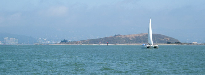
Brooks Island, located off the Richmond shoreline, has a storied past. After numerous commercial proposals, the island finally became part of the East Bay Regional Park District (EBRPD) in 1968. Access is now permitted only as part of an EBRPD naturalist tour. Photo by Joel Williams
By Captain Ray
Published: December, 2010
Brooks Island, a small and somewhat inconspicuous bit of land off the Richmond shoreline, has an area of only 75 acres and is 159 feet at its highest point. When viewed from almost anywhere around the Bay, it appears (if noticed at all) as a low, scrubby hill. Because it is so close to the shoreline, observers often fail to realize that it actually is an island. This tiny island and approximately 300 acres of marsh and water that surround it comprise the Brooks Island Regional Shoreline; all of it is a wildlife preserve operated by the East Bay Regional Park District (EBRPD).
The island consists of a rocky ridge that tapers down to a coastal plain surrounded by mud flats and very shallow water. The ridge is Franciscan chert, a dense, red, sedimentary rock; it is part of the same formation seen on Albany Hill (just 2˝ miles to the east) and the Coyote Hills in Fremont (about 25 miles to the southeast). The lower slopes are limestone.
Though small, Brooks Island has had a colorful history. The Ohlone lived on the island for thousands of years, the shellfish in the surrounding shallows providing a dependable source of protein. The shellmounds they left are ample evidence of their presence.
The Spanish named it Isla de Carmen in 1775, but by 1850 charts referred to it as Brooks Island. It has had several other names as well. For a time it was known as Rocky Island, because from 1892 until 1938 limestone was quarried from its south side. Reportedly, San Quentin prisoners used this stone to build Treasure Island and the south cell block of their prison. This limestone was also utilized when the Army Corps of Engineers constructed the Richmond breakwater that extends west from the island and protects the Richmond Inner harbor. Another name was Sheep Island, because ranchers tried (unsuccessfully) to raise sheep there.
Over the years, other uses were proposed for Brooks Island. In the 1870s, the Central Pacific Railroad wanted to build a freight terminal there. The U. S. Navy proposed leveling the island to build a battleship dock during World War I, but opted for Hunters Point instead. In the 1950s, the City of Richmond had plans for a heliport. Developers also wanted to flatten the island and sell industrial and commercial lots.
In the 1960s, Brooks Island was leased by the Sheep Island Gun Club, which counted amongst its members Bing Crosby and restaurateur “Trader Vic” Bergeron. The club stocked the island with a variety of exotic game birds, all of which have now died out. They even stocked the island with deer, but they kept swimming ashore. In 1968, the island’s commercial exploitation came to an end when it was made part of the park district. Access is now permitted only as part of an EBRPD naturalist tour. See their website, www.ebparks.org for the details.
During our stroll around the island, we saw gulls, terns, surf scoters, and loons, white tailed kites and black oystercatchers, cormorants and Canada geese, red-tailed hawks and black-crowned night herons. But the high point for me (pun intended) was the view from Jefferds Peak, the top of the island. It is only 159 feet high, but it affords a unique view of the Bay, one that very few people have seen.
Ray Wichmann, is a US SAILING-certified Ocean Passagemaking Instructor, a US SAILING Instructor Trainer, and a member of US SAILING’s National Faculty. He holds a 100-Ton Master’s License, was a charter skipper in Hawai’i for 15 years, and has sailed on both coasts of the United States, in Mexico, the Caribbean, and Greece. He is presently employed as the Master Instructor at OCSC Sailing in the Berkeley Marina.
