For most people, San Francisco Bay means a view. Its gleaming waters are typically seen from a distance, glimpsed as a sideways blur from a fast-moving car, briefly studied from a house or restaurant window, or momentarily admired from a hilltop.
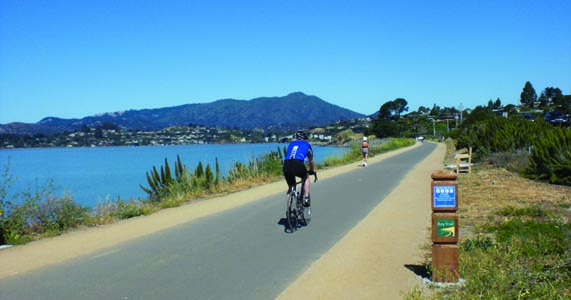
Currently, more than 325 miles of the Bay Trail are open to the public. The Bay trail will eventually encircle the entire Bay with a continuous 500-mile biking and hiking trail. Photo courtesy of SF Bay Trail Project
By Maureen Gaffney
Published: September, 2012
For most people, San Francisco Bay means a view. Its gleaming waters are typically seen from a distance, glimpsed as a sideways blur from a fast-moving car, briefly studied from a house or restaurant window, or momentarily admired from a hilltop. The Bay is out there, before our eyes, but at the same time it’s invisible. Few come to know it intimately. Few realize what this great 450-square-mile estuary offers.
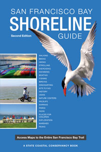
To answer this call, the second edition of the popular San Francisco Bay Shoreline Guide has just been published. This book is a passport to the San Francisco Bay Trail and is essential for anyone who wants to explore our remarkably diverse shoreline.
Since the book’s first publication in 1995, nearly 150 miles have been added to the Bay Trail. Published by UC Press and funded by the State Coastal Conservancy, the guide is comprehensive, compact, user-friendly and studded with full-color maps and illustrations that cover the more than 325 miles of the Bay Trail currently open to the public. The Bay Trail will eventually encircle San Francisco Bay with a continuous 500-mile bicycling and hiking trail. In the meantime, with the new Shoreline Guide in hand, myriad adventures are available today.
The Shoreline Guide shows how the Bay Trail offers access to commercial, industrial and residential neighborhoods, featuring points of historic, natural and cultural interest; recreational areas like beaches, marinas, fishing piers, boat launches; and over 130 parks and wildlife preserves. Passing through highly urbanized areas like downtown San Francisco as well as remote natural areas like the San Francisco Bay National Wildlife Refuge, the Bay Trail consists of paved multi-use paths, dirt trails, bike lanes, and sidewalks.
The guide also includes natural, cultural, and historic features that reveal the Bay Area’s rich multicultural heritage. It highlights the various ecosystems that coexist along this unique urban shoreline. Common plant and animal species are illustrated and described for easy identification. Access maps with icons indicate sites suitable for various activities: boating, fishing, biking, hiking, bird watching, picnicking and wheelchair riding. A reference section contains public transit information, names of Bay-related organizations and many useful phone numbers and websites.
Recently added segments take you to the hustle of an industrial working waterfront at the Port of Oakland, bring you solitude near a restored wetland in Sonoma, or allow you a car-free commute on a Marin multi-use path. The Moffett Field segment in Mountain View—a long-standing and particularly vexing gap—was opened amid much fanfare in 2010. With the completion of that two-mile segment, 26 miles of continuous shoreline Bay Trail were suddenly available to the public for cycling, commuting, walking and birdwatching.
A .75-mile segment of the Bay Trail and the Bay Area Ridge Trail are also now open at the newly minted Glen Cove Waterfront Park in Vallejo. This small but important segment links to existing Bay and Ridge Trail segments in neighboring Benicia State Recreation Area, providing a continuous 4.5-mile waterfront path with spectacular views. The guide describes these and many more outings in detail.
To purchase the guide, visit Bay Crossings in the San Francisco Ferry Building ($29.95). For more information about the Bay Trail or to order your copy online, go to www.baytrail.org.
The San Francisco Bay Trail Project is supported by the Association of Bay Area Governments, the Metropolitan Transportation Commission and the State Coastal Conservancy.