Forget about "Where’s Waldo." The question on many Bay Area residents’ minds in June of 2013 will be "Where’s Kurt?"
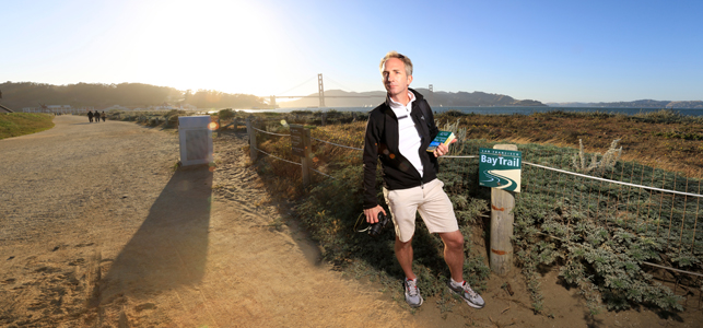
Armed with the new Bay Trail boxed map set, intrepid trekker Kurt Schwabe gets ready for his quest to circle the Bay in 30 days. Photo by Kingmond Young
By Brenda Kahn
Published: June, 2013
Forget about "Where’s Waldo." The question on many Bay Area residents’ minds in June of 2013 will be "Where’s Kurt?"
The Kurt in question is intrepid trekker Kurt Schwabe, who is dedicating the month of June to circumnavigating the San Francisco Bay Trail, a network of shoreline pathways ringing the region’s central geographic feature.
Every day, Schwabe will set out from his condo in San Francisco’s Pacific Heights neighborhood and try out a new segment of the Bay Trail, getting to the trailhead by public transit. At night, he will return home to download his photos and to blog about his experience. Public transit figures big in Schwabe’s itinerary: He plans to ride buses, trains and ferries to and from the trailheads, each morning picking up from where he left off the day before, using a Clipper® card to pay his fares.
Why the fixation on public transit? Partly because Schwabe met his wife while riding Muni’s 30-Stockton, partly because public transit is the most sustainable way to reach the region’s great outdoors and partly because public transit will allow him to get home at night without having to backtrack to a car parked at his starting point. "The Bay Trail is connected to public transportation at just about any point along our shoreline," Schwabe writes in one of his pre-trek blog posts.
A lifelong avid outdoorsman who spends a good part of each week running and walking — often with his wife Linda as well as his poodle mix, Oscar — Schwabe has had a varied career in real estate, advertising, finance and fundraising, "riding one bubble to the next," he said. He cooked up the idea for the Bay Trail trek when his job with an online marketing company dried up this past February. He was turning 45, and it was time for a new direction.
On a walk along the waterfront in Marin, Schwabe noticed a Bay Trail sign, and wondered about the extent of the network. Investigating it further, he became intrigued by the notion of a trail system that connects "all of the Bay Area, all the different cities and all the different cultures," he explained. He decided to tackle the whole thing, and to become a self-appointed Bay Trail ambassador by spreading the word to others who might be similarly fuzzy on the concept — and by applying his photography skills to documenting the wildlife and other features along the trail.
The timing for Schwabe’s adventure couldn’t be better: It coincides with the publication of a handsome new boxed set of Bay Trail map cards, each with a suggested trip (see infobox on page 15). The maps will be a mainstay of Schwabe’s backpack, along with the latest edition of the San Francisco Bay Shoreline Guide, which showcases the trail’s ecological riches and recreational offerings.
Schwabe’s trek will shine a spotlight on gaps in the trail where planners are still trying to find a pathway along the edge of the Bay. He’ll also have to contend with gaps in public transit service, and anticipates having to drive to at least one trailhead, along the northern edge of San Pablo Bay.
Schwabe’s plan has won the enthusiastic endorsement of the Association of Bay Area Governments (ABAG), which runs the Bay Trail Project. ABAG Project Director Laura Thompson has enlisted Schwabe in using and promoting a new interactive online map tool that dishes up the entire Bay Trail network on laptops, desktops and mobile devices: baytrail.org/maps-online.html.
The Metropolitan Transportation Commission (MTC) is co-sponsoring the effort by providing Schwabe with Clipper value as a way of showcasing the regional transit fare-payment program, which MTC manages, and the Bay Trail project, which receives yearly grants from MTC.
A veteran of a number of marathons and triathlons, not to mention climbing Mt. Shasta and trekking the Himalayas, Schwabe is used to endurance sports, and expects to walk anywhere from five to 13 miles a day, cumulatively covering nearly 250 miles by the time the month is over.
Observers can monitor Schwabe’s movements in real time via a GPS tracker that will link to his blog, located at walkingthebaytrail.com. Schwabe is inviting interested citizens, the media and local officials to join him on a trail segment and to experience the Bay Trail first hand. They can arrange to meet by e-mailing him at kurt_schwabe@yahoo.com.
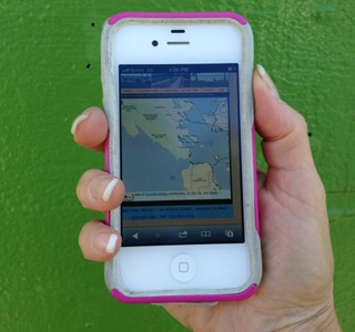
Schwabe will try out a new digital version of the Bay Trail system map.
